About Bloor Homes
Bloor Homes is a family-owned private housebuilder with a reputation for quality, consistently achieving the highest five-star rating for customer satisfaction in the annual National Housebuilders Federation National New Homes Customer Satisfaction Survey.
Find you more at: https://bloorhomes.com/
The site
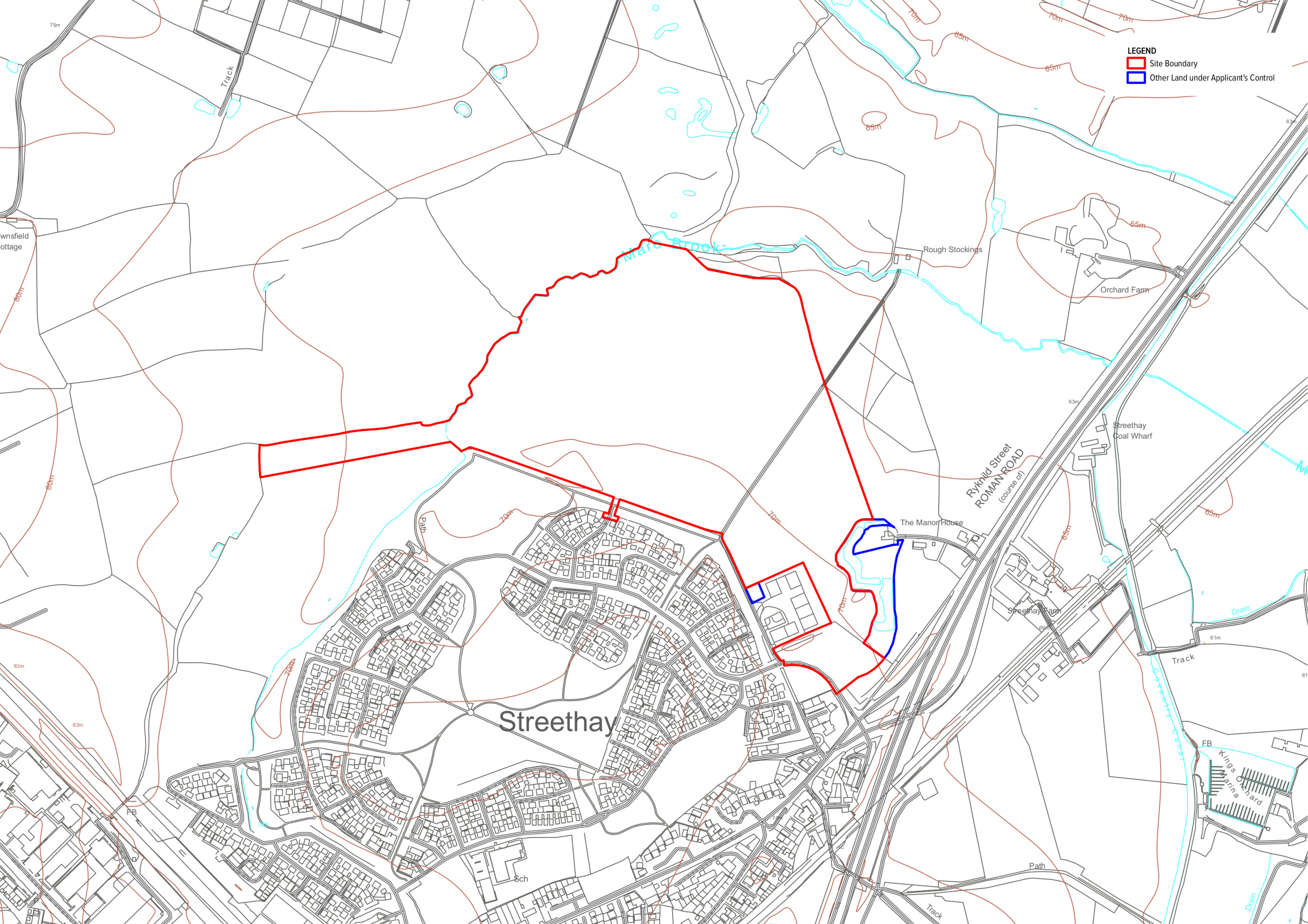
The 25ha site is located to the north of Streethay, adjacent to the recently built Streethay strategic development allocation, Roman Heights. It comprises a large open agricultural field bounded by hedgerow and trees.
There is existing residential development immediately to the south of the site, development associated with High Speed 2 (HS2) immediately to the north, and the A38 to the east. A Scheduled Monument and existing agricultural buildings also bound the site to the east. As such, the site is contained by existing development on three sides.
The site is currently predominantly in arable agricultural use and as such it has low biodiversity value. It is currently not accessible to the community with the exception of a public right of way footpath which skirts a small portion of the site on its western edge.
Planning policy context
The site is located outside the greenbelt and occupies a highly sustainable location on the edge of the settlement boundary of Streethay. The Lichfield District Council Strategic Housing Land Availability Assessment (SHLAA) has assessed the site as being “Suitable”, “Available” and “Achievable” for residential development within the next 6-10 years. As such the site was allocated for residential development in the recently withdrawn submission draft of the Lichfield Local Plan.
A Local Plan is a document that sets out the vision for future development in a local authority area. Government requires that all local authorities have an up-to-date local plan in place and review it at least every five years.
Lichfield District Council’s existing Local Plan was adopted in 2015 and is now considered significantly out of date. The Council is now working to produce a new Local Plan and the site is being promoted for allocation in the review to contribute to housing need. A previous draft of the Local Plan Review was submitted to the Government’s inspectors for examination following extensive consultation. This draft included the site being promoted by Bloor Homes as an allocation for residential development. However, the plan was withdrawn from Government examination and the review process has been restarted. The site continues to be promoted as an allocation in this ongoing process
The new Local Plan will need to demonstrate that the district’s housing needs are being met and proposals by the Government to reform the National Planning Policy Framework (NPPF) will see the number of homes that need to be delivered in the District increase significantly.
With the existing Local Plan now significantly out of date, housing targets likely to significantly increase and the Council restarting the process of producing a new Local Plan for the area, Bloor Homes is preparing an outline planning application while continuing to promote the site through the preparation of a new Local Plan. This will enable the early delivery of much-needed new homes at a site that has previously been acknowledged by the District Council as being suitable for this purpose.
Site constraints and opportunities
How local features and landscape have shaped our thinking for the proposed layout of the new neighbourhood.
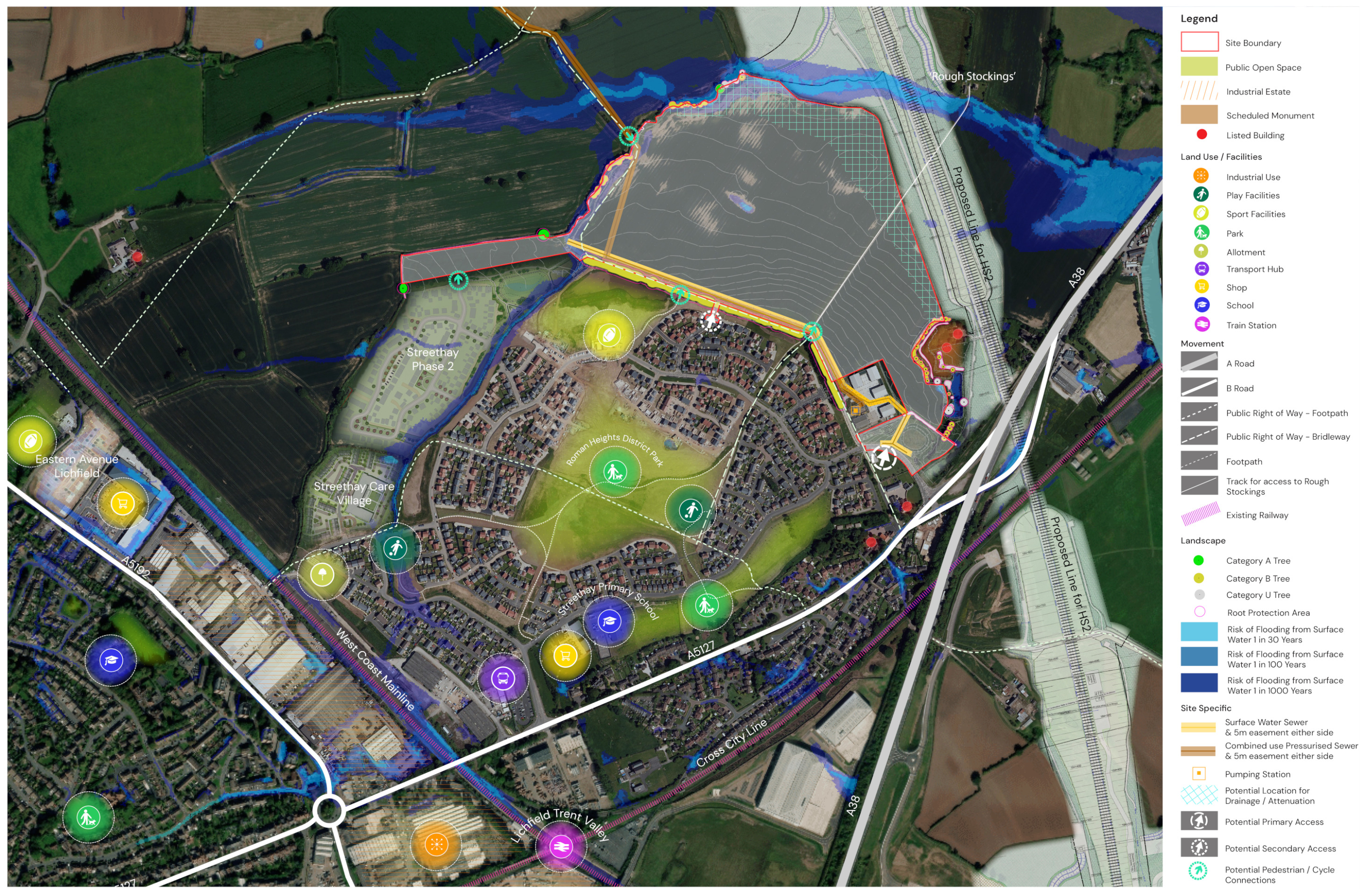
In preparing the concept layout for the site, the technical team appointed by Bloor Homes first of all considered the landscape features, topography and local context of the area. The following plan shows some of the features and constraints that have informed the plans. Key features include a scheduled monument to the east of the site. There is also a public right of way (Steethay 3) which crosses a small section of the western portion of the site. There is a very small area of surface water flood risk centrally within the site which will form the basis of an ecology pond as part of the extensive public open space in the emerging plans.
A plan showing site features that need to be considered in preparing the concept layout for the site - click to enlarge
The emerging vision for high-quality homes, extensive public open spaces and community facilities
Bloor Homes is preparing an outline planning application for a landscape-led development of new homes and green open spaces. The proposed new neighbourhood could deliver:
- A landscape-led development providing up to 500 high quality homes in a range of styles and tenures to meet housing need in the district.
- Circa 50% of the site area would be provided as open space, including extensive landscaped public open space and habitat areas.
- Up to 28% of the new homes would be affordable homes, providing opportunities for key workers and people on low incomes to secure a home of their own.
- As part of the housing mix, there are opportunities to provide homes for people looking to downsize into more manageable homes or secure an accessible property.
- The retention of existing trees and hedgerows save for small areas requiring removal for drainage and highways, and enhanced by extensive additional planting.
- Extensive green public open space and habitat creation, boosting the biodiversity value of the site with the aim of meeting and where possible exceeding local and national Biodiversity Net Gain requirements.
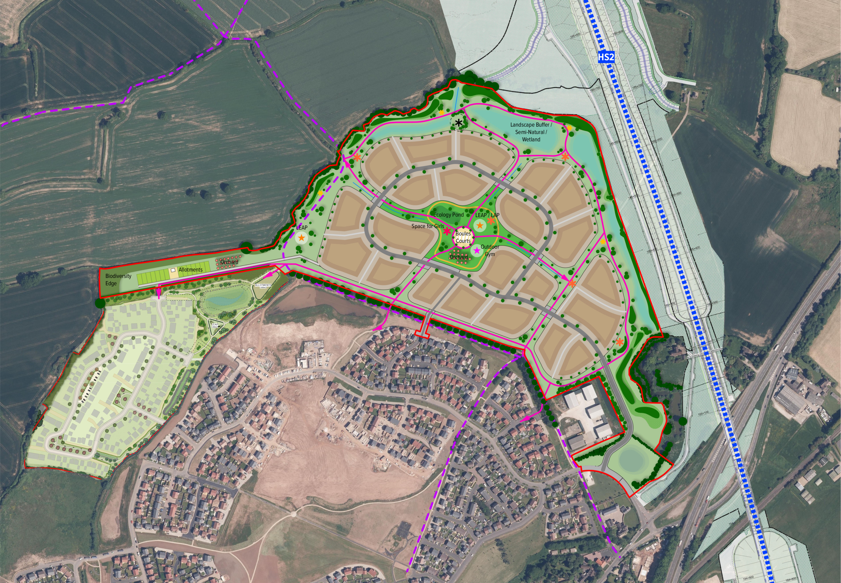
- A range of community open space facilities to be informed by local feedback, including play areas, boules courts, allotments, community orchards, areas of habitat and an ecology pond.
- Primary vehicular access from Thompson Way close to its junction with the A5127 and to the east of the existing Roman Heights development with the aim of minimising traffic impacts.
- A network of walking and cycling routes through extensive green public open space on land that has previously been largely inaccessible to the public. The existing public rights of way to the south and west of the site will also be retained and enhanced to improve accessibility for the whole community.
- A sustainable and potentially gas-free development with all homes provided with measures such as PV cells, air source heat pumps, EV charging infrastructure, and very high levels of insulation and energy efficiency.
- Significant investment into local infrastructure such as healthcare, education and highways, informed by consultation with statutory bodies such as the NHS, the local education authority, highways authorities and others, secured via legal agreement.
- A site that has been identified as being suitable for residential development by Lichfield District Council in the Strategic Housing Land Availability Assessment (SHLAA) and formed part of a proposed site allocation in the withdrawn Local Plan.
- Unlike other recent proposals in the district which have been brought forward by land promoters before being sold with planning permission, this is a housebuilder-led proposal which will be designed and delivered by Bloor Homes, a high-quality, five star rated, family-owned company.
Our concept masterplan for the landscape-led new neighbourhood north of Streethay – click to open our interactive map
Homes and community facilities
House types
The planning application will be an outline planning application. This type of planning application sets out the broad principles of development, such as concept layout, infrastructure and access arrangements. Details such as house types, architecture etc would be subject to subsequent further planning application(s) (called Reserved Matters planning applications). This would involve further consultation with the community.
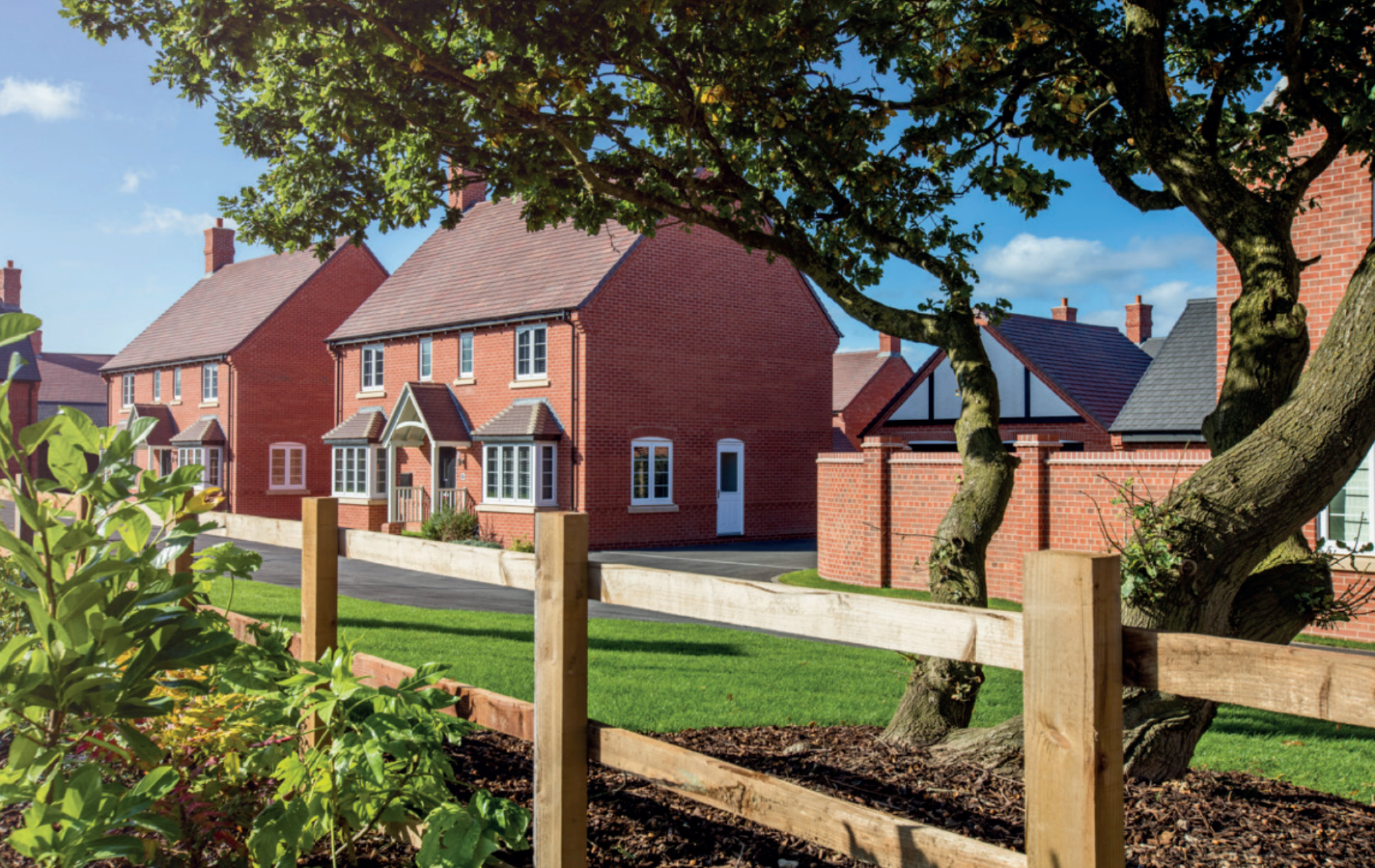
However, we have provided imagery of existing Bloor Homes developments on this website to provide an idea of the types of high-quality homes we build.
Please use our online questionnaire to tell us the types of homes you think should be prioritised in Streethay.
Affordable homes
Up to 28% of the new homes will be affordable homes, providing opportunities for those on lower incomes with connections to the local area to secure a home of their own. Affordable housing is anticipated to be provided in a mix of affordable rent, shared ownership and First Homes.
If feedback indicates a preference, we would be happy to work with Lichfield District Council for Local Occupancy Criteria to be applied to the affordable housing provision, ensuring that it is prioritised for people with local connections.
Sustainable homes
We want to deliver homes that our sustainable now and contribute to a cleaner, greener future.
We know that sustainability is hugely important to communities across the country, and we will work to ensure that the new homes we deliver for Streethay meet the very latest standards in sustainability.
We are proposing homes that consume less energy by using the latest materials and techniques to maximise insulation, air tightness and heat recovery, with the incorporation of PV cells (solar panels), creating an uplift in energy efficiency of 75-80%. There is also the potential that the new neighbourhood will be a gas-free neighbourhood, with all homes provided with air source heat pumps as standard.
The new homes will incorporate sanitaryware and appliances that meet the highest water efficiency standards.
Electric vehicle (EV) charging points will be provided for all homes with on-plot parking, together with access to communal EV charging points for the whole neighbourhood.
To minimise the impact of construction, we always aim to procure materials from sustainable sources and recycle construction waste as far as is possible. Any future planning permission will be conditioned by a Construction Management Plan to ensure that impacts of construction on the existing community is minimised, particularly mindful of the significant disruption that recent and ongoing development and infrastructure works in Streethay are likely to have caused for residents.
We will be delivering a sustainable development with the potential to be gas-free, with measures such as EV charging, PV cells, and air source heatpumps - click to enlarge
Investing in wider community infrastructure
A key consideration with a planning proposal such as this is to ensure that local services receive the investment they need to accommodate housing growth in the local area. The development will generate significant investment into local infrastructure such as healthcare and education, and this will be informed by consultation carried out by Lichfield District Council with statutory bodies such as the NHS and local education authority and will be secured via legal agreement between Bloor Homes and the Council.
In addition to this direct investment into schools, healthcare, highways and other local services, the development will also provide Community Infrastructure Levy (CIL) payments approaching £2 million.

The development will generate significant funding for key infrastructure such as healthcare and education, to be determined in consultation with bodies such as the NHS, local education authority, etc
Helping to deliver Streethay’s Community Centre
We are aware that although there is planning permission in place for Streethay’s new community centre in the Roman Heights neighbourhood, the funding is not currently in place to deliver it. We are keen to work with community representatives to explore opportunities for our emerging plans to help unlock the delivery of this important community resource.
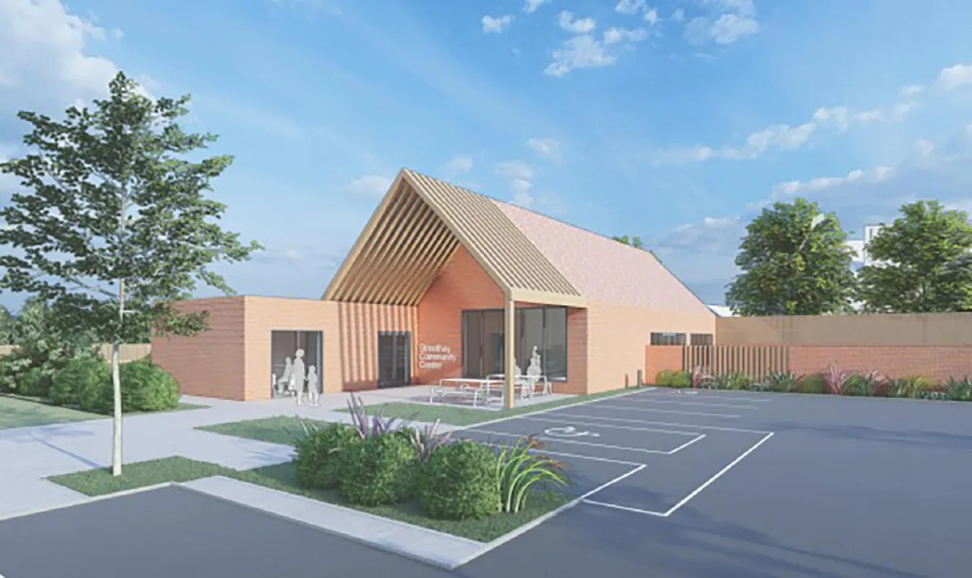
The development could provide funding needed to deliver Streethay’s long-awaiting community centre (image source - planning application 24/00490/FUL, LDC planning portal)
Green infrastructure
We want to ensure that natural habitats are protected while we deliver new homes for people and families.
We are conscious of the ever-increasing importance of ensuring that development is sustainable, protecting and enhancing natural habitats and green infrastructure as much as possible whilst delivering much needed homes for people and families.
Alongside the delivery of much needed high quality new homes, the proposed development will also see approximately 50% of the total site area retained as open space, including extensive landscaped public open space, providing public recreational opportunities on a site that is currently not accessible to the community apart from an existing PRoW footpath on its western edge. This will deliver a significant benefit in terms of enhancing local open space provision.
There are existing trees and hedgerows around the perimeter of the site which will be retained as part of the open space proposals, and these will be enhanced with extensive additional planting. There will also be extensive planting of new trees across the site.
A network of walking and cycling routes will be set within the extensive new public open space and there is scope to provide additional open space facilities such as allotments, community orchards, play areas, pocket parks, a dedicated space for girls, informal play and habitat areas including an ecology pond.
The site is currently largely comprised of improved agricultural land, which is of relatively low value in terms of biodiversity. The retention of existing trees and hedgerows, along with the planting of hundreds of new trees and other plants and the use of SuDS features to create new wetland features, will create new more diverse habitats. This will significantly boost the biodiversity value of the site, with scope to meet and where possible exceed local and nation Biodiversity Net Gain (BNG) requirements.
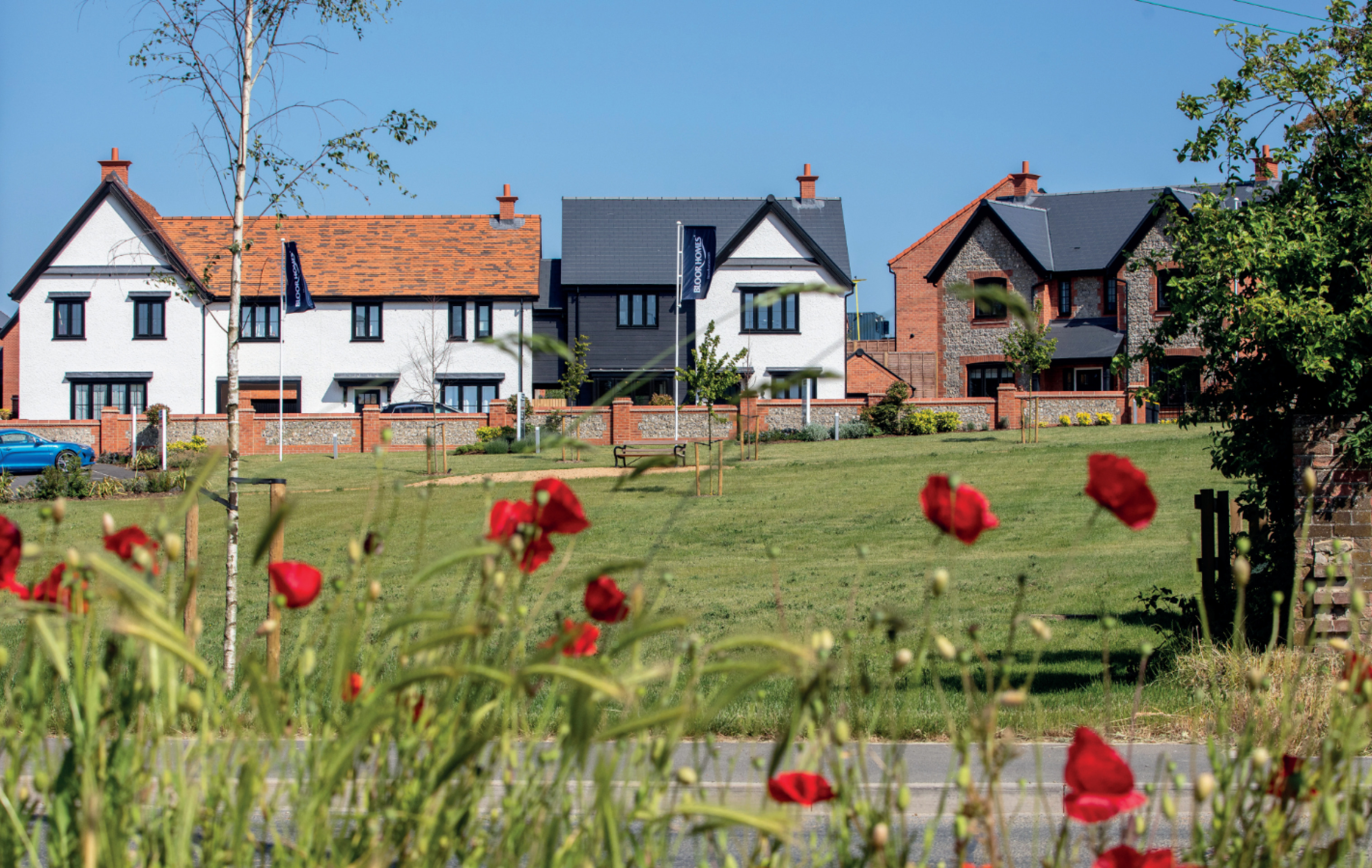
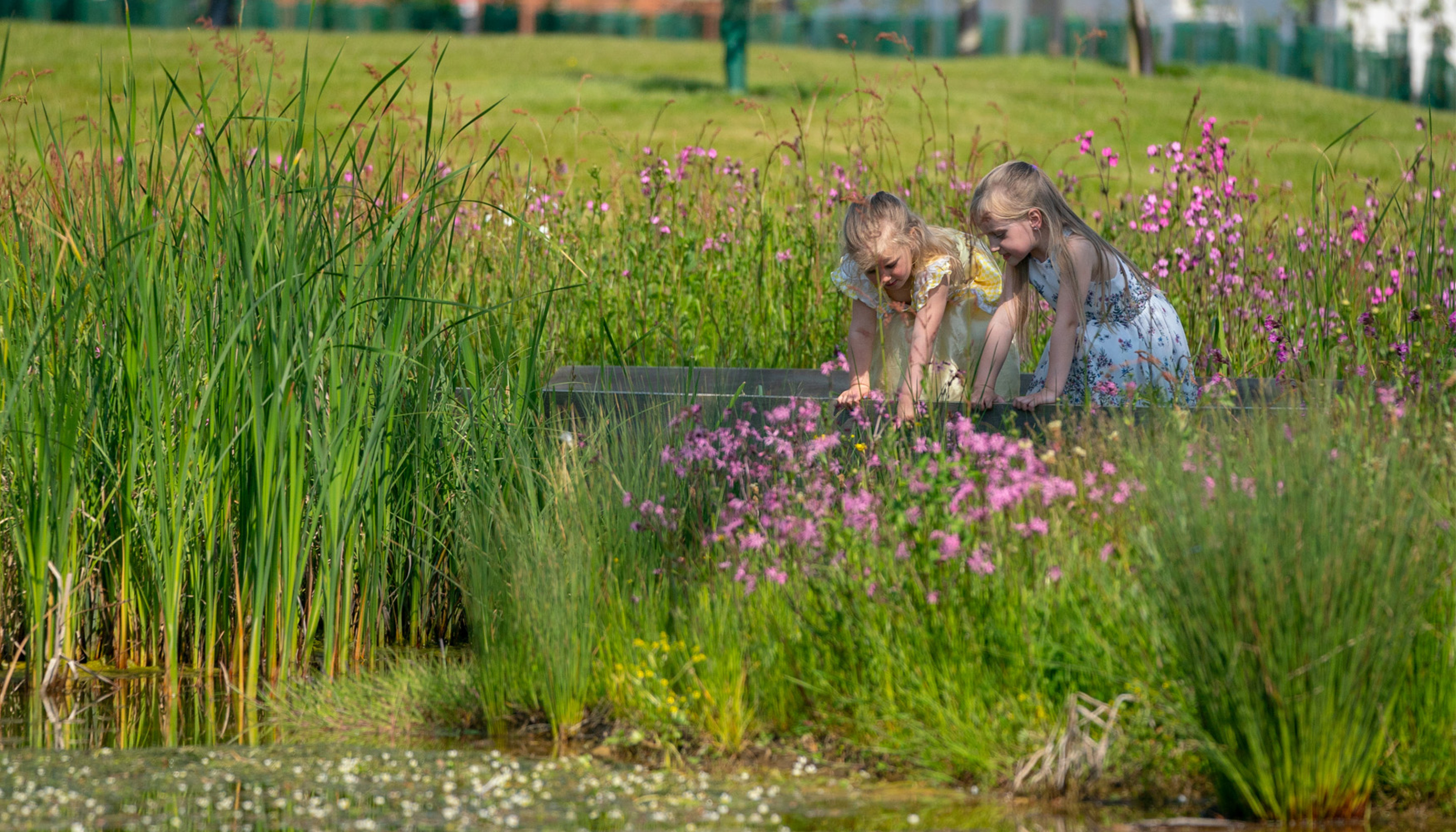
Building with Nature
Bloor Homes is signed up to the Homes for Nature programme which will see the installation of swift nesting boxes in every new home and hedgehog highways between gardens.
Access and local highways
Bloor Homes has appointed a specialist consultant to undertake technical work relating to access and highways. It is intended that primary vehicular access would be taken off Thompson Way at a point to the east of the existing Roman Heights neighbourhood, close to the junction with the A5127. This would provide direct access to and from the primary highways network without impacting on Roman Heights. This will be particularly important during construction to ensure any impact on existing residents is kept to an absolute minimum. The potential for secondary access onto Faraday Road facilitating access to local services is being explored, subject to discussions with local highways authority.
The traffic impacts of the development will be fully considered, assessed and mitigated as part of a comprehensive Transport Assessment to be submitted with the outline planning application. A pre-application consultation has already begun with the Local Highways Authority and National Highways to agree a strategy to ensure all required assessments are undertaken and a site access strategy agreed.
This work will include considering the impact of the increase in traffic arising from the development on the highway network, taking into account any other committed developments in the area (i.e. the cumulative impact). This is particularly important given current highways impacts in Streethay from ongoing developments and infrastructure works.
Active travel
A Travel Plan will also be developed to promote sustainable modes of travel to and from the site There are a number of walking and cycling routes Roman Heights into the site providing excellent active travel links to nearby sport, recreation and open space uses as well as a newly delivered local centre in Roman Heights. The site also located within reasonable walking distance of local bus stops and Lichfield Trent Valley Railway Station.

Flooding and drainage
A Flood Risk Assessment and Drainage Strategy will be submitted within the planning application to demonstrate that the proposed development of the application site can be facilitated without increasing flood risk elsewhere.
The site is located within Flood Zone 1 of the Environment Agency’s flood map for planning. This means it is considered to be at the lowest risk of fluvial flooding.
There are small areas to the fringes (associated with the Mare Brook) and within the centre of the site which possess a risk of surface water flooding. Flood risk from all other sources investigated has been deemed to be low. An ecology pond has been proposed to address the identified small area of surface water flood risk in the central area of the site as part of a wider central area of landscaped public open space and habitat. The ecology pond will not only mitigate against the risk of surface water flooding but will provide additional environmental benefits.
A drainage strategy will be submitted which will cater for all runoff produced on site for up to a 1 in 100-year critical storm event plus an additional 40% to account for climate change. Surface water runoff will drain via a combination of a gravity conveyed surface water sewer network and swales. The conveyance features will discharge via a cascade of attenuation ponds which will incorporate permanently wetland areas within their structure to deliver biodiversity benefits. The cascade of ponds will be located adjacent to the northern edge of the development, where ground levels are the lowest.
Runoff will ultimately discharge from the cascaded ponds via a swale outlet into the Mare Brook at existing greenfield runoff rates, this will ensure that the development does not increase flood risk elsewhere.
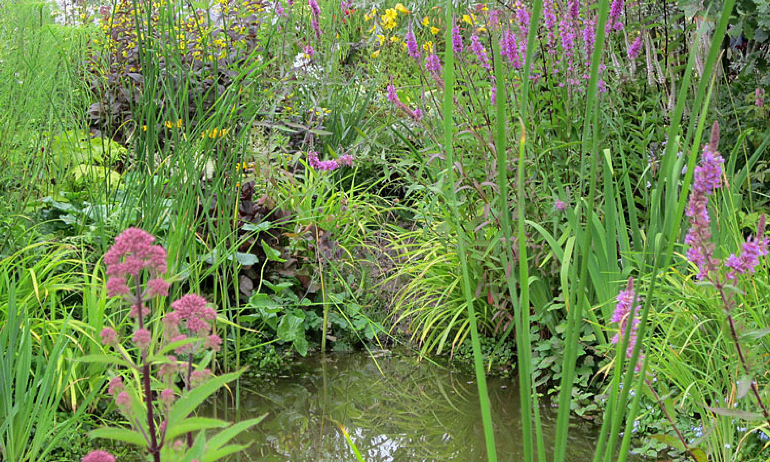
Sustainable Urban Drainage System (SUDS) will manage surface water drainage while providing wetland habitat to boost the biodiversity value of the site.
Noise
The principal sources of noise affecting the site is predicted to be from road traffic using the A38 some distance to the southeast, and rail noise and vibration from HS2 adjacent to the eastern boundary. These potential impacts would be addressed through the use of appropriate glazing and ventilation specifications, dwelling orientations and stand-offs, and the use of acoustic screening where required. Landscape buffers are also proposed between potential sources of noise and residential development.
Heritage and archaeology
An Archaeology and Built Heritage Assessment is being prepared and will be submitted with the planning application. The site does not contain, nor does it form any part of, any designated heritage assets. In the wider area there are seven Grade II listed buildings and one Scheduled Monument. Of these identified designated heritage assets, only the Scheduled Monument and two listed buildings within its extent have been assessed as requiring further analysis to establish whether the proposed development would result in harm to their significance.
The Scheduled Monument is located adjacent to the site's eastern boundary and comprises the moated site and plunge bath at The Manor House. The assessment of the scheduled monument and its associated listed buildings identified that the key contributions to their significance to ensure the development does not impact on them.
Whilst the site lies adjacent to the west of these assets, it is separated by a dense area of hedgerows and trees. The emerging illustrative concept masterplan identifies appropriate mitigation to be implemented in the design of the development proposals to reduce or remove any potential adverse effects on the assets like offsetting development and inclusion of generous areas of open space to east end of site, adjacent to the moat, such that will serve to preserve the immediate rural setting in this direction.
No other designated heritage assets have been identified as sensitive to the proposed development of the site and based on the current information, there is no evidence to suggest that land within the site will contain archaeological remains which would be of high significance and require preservation in situ.
Other technical considerations
In preparing an outline planning application for the proposed development, a full suite of technical studies is being completed, including Highways, Flooding and Drainage, Ecology, Utilities, Noise, Heritage, Air Quality, Contamination etc. However, in line with the assessment of Lichfield District Council in the Strategic Housing Land Availability Assessment (SHLAA) and the site’s proposed allocation in the withdrawn Local Plan, it is not anticipated that there will be any significant technical constraints to delivering a high quality, sustainable new neighbourhood at this site.
Have your say
Your feedback will help to shape the emerging plans, including providing insight as to current issues locally that it will be important for us to consider, the types of homes that you feel Streethay needs, the types of open space facilities that the community would benefit from, and your priorities for community facilities and infrastructure.
Once you have had an opportunity to read an overview of the emerging plans, and view the interactive map, please take a moment to complete our feedback questionnaire.
